|
|

|
|
Wildlife Watching Locations
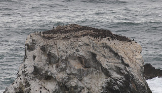
Common Murres off Devil's Slide Trail
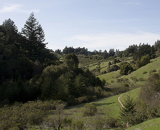
Peters Creek Trail, Long Ridge Open Space Preserve
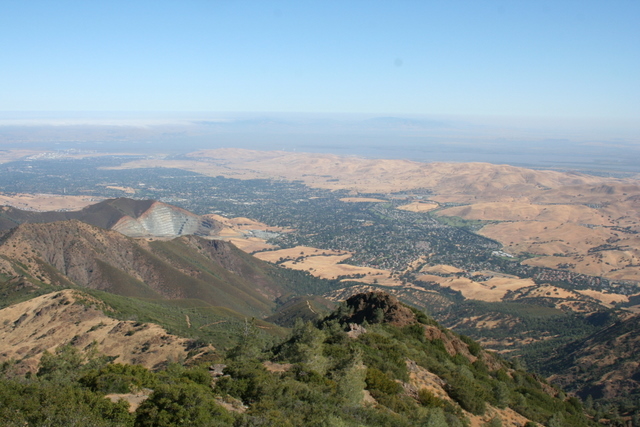
View from Mount Diablo
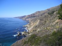
Big Sur coast
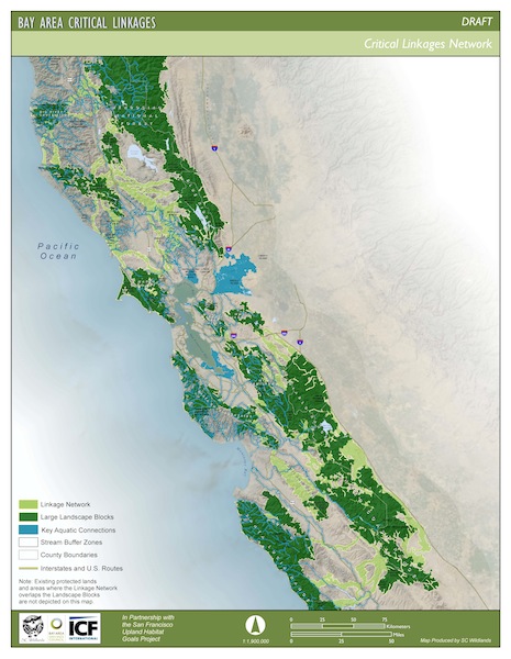
Critical Linkages
We are blessed with an abundance of natural places which provide many wonderful opportunities for watching wildlife. Based on our own experience of wildlife watching over 25 years, combined with the recommendations of many fellow enthusiasts, we have compiled the following list. It is organzed by regional divisions.
San Francisco & Marin County
Sonoma, Napa and Solano Counties
Coastal Region South of San Francisco
Santa Cruz Mountains San Mateo County
Santa Clara County Inland
- Arastradero Preserve, Palo Alto
- Foothills Park, restricted to Palo Alto residents and guests.
- Jasper Ridge Biological Preserve
Access is restricted to docent-led tours by appointment.
- Hidden Villa
- Stevens Creek County Park
- Rancho San Antonio County Park
- Sierra Azul Open Space Preserve
- Los Gatos Creek
- Almaden Quicksilver County Park
- Ed Levin County Park
- Joseph D. Grant County Park
Birding tips for Grant Park from Santa Clara Valley Audubon Society
...link
- Sierra Vista Open Space Preserve
- Alum Rock Park
- Rancho Canada del Oro Open Space Preserve
Some great wildlife sightings, recorded in 2009 and 2010, with photographs
...link
- Uvas Canyon County Park
- Henry Coe State Park
An overview of Wildlife - includes links to lists, with photos of mammals, birds, reptiles, amphibians, fish, butterflies and wildflowers.
...link
Santa Clara County Shoreline
East Bay Shoreline
East Bay Inland
Santa Cruz Mountains Santa Cruz County
Regional Guides and Maps
- Wildlife areas in the Bay and Delta area by California Dept. of Fish and Wildlife. Map with links to more details for each area.
...link
- Marin County Parks and Open Space
...link
- Map of all San Mateo County parks by the San Mateo County Parks Foudation.
...link
- East Bay Regional Park District - map with all parks and links to indvidual parks.
...link
- Guide and map to multiple locations within Monterey Bay National Marine Sanctuary and what kind of wildlife to expect at each location.
...link
- 101 Great Hikes Above Silicon Valley by Miriam Nuney. An ebook with detailed description of trails in many of the locations listed on this page.
...link
Resources for Natural and Protected Areas
- Critical Linkages species-based priority landscape linkages - maps and other resources from SC Wildlands
...link
- Bay Area Important Bird Areas and Audubon Chapters, created by Golden Gate Audubon
...link
- San Francisco Bay National Wildlife Refuge Complex is a collection of seven National Wildlife Refuges - Antioch Dunes National Wildlife Refuge, Don Edwards San Francisco Bay National Wildlife Refuge, Ellicott Slough National Wildlife Refuge, Farallon National Wildlife Refuge, Marin Islands National Wildlife Refuge, Salinas River National Wildlife Refuge, and San Pablo Bay National Wildlife Refuge.
...link
- SIMoN (Sanctuary Integrated Monitoring Network), a very comprehensive site covering the Northern California National Marine Sanctuaries which include Cordell Bank, Gulf of the Farallones and Monterey Bay. There are maps, lists of species and other resources.
...link
- San Francisco Bay Trail Project - proposed 500 mile network of trails that, when complete, will encircle San Francisco and San Pablo Bays.
...link
- Bay Area Ridge Trail - ultimately to be a 550+ mile trail encircling the San Francisco Bay along the ridge tops. 310 miles are available now.
...link
- Salt Pond Salt Pond Restoration Project Maps. Many detailed maps of salt pond areas around the bay.
...link
- Guide to San Francisco Bay Area Creeks by the Oakland Museum of California. Includes interactive maps, guided tours, and many fascinating tidbits of information.
...link
|
|